Showing posts with label heritage. Show all posts

Monday, February 06, 2023

RGB Monday

A colorful part of the residential colony of Kodaikanal

Kodaikanal is a 175 years old town established by the British as a refuge from the plains' high temperature and tropical diseases. Kodaikanal is located above 2000 meters of sea level.

Sacred Heart Church, Kodaikanal.  It is one of the larger and oldest churches in Kodaikanal,  built 100-plus years ago and was renovated lately. 

Thursday, September 10, 2020

Washing and Packing of Carrots


Apart from tourism and cold weather, Kodaikanal is popular for vegetables that grow in mountains esp. Carrot is produced at large, along with the medicinal hill garlic which is an important cultivation in Kodaikanal upper villages of Poombarai, Mannavanur, Polur, Kukkal and Vilpatti. An important thing about the Kodaikanal Hill Garlic was it was granted by the prestigious ‘Geographical Indication’ (GI) tag – a name or sign used on products which corresponds to a specific geographical location or origin.


Going past the Kodaikanal town on the observatory road would take one to one of the beautiful mountain village called Poombarai at about 20 km from the town and Kukkal is another peaceful and pleasant village of the mountains about 10 km from there is where these photos of Carrots were shot.  What you see here is farmers washing carrots near a small canal that flows from Kukkal Lake above Kukkal village and stuffing them in sacks before taking them to markets in mini trucks.

Carrots don't look pretty when uprooted from the muddy soil because the condition of the soil - deep loose loamy - is left in a state of dirt that does stick to the carrot  and it's only after hard washing reveals its bright color. The carrot grows above the elevation of 1500 meters and is cultivated yearlong with assured irrigation unlike the land below the range (of 1500) that rely only on monsoon rain. Kodaikanal upper villages are located around 2000 meters, experiencing cool weather throughout the year and I enjoy taking drives around the scenic landscapes of terrace farming and forest.

Thursday, February 06, 2020

TELC Jubilee Church (aka German Church), Kodaikanal

Every time I decide to travel, even if the destination was same, I do some research for any new places to see because I think only if there’s a search for something a travel would be interesting.  And old is something always fascinate me and top my list of places to see, more than anything newly constructed. If you’re a follower of my blog, would know Kodaikanal is a beautiful place where I had yearly vacation in last several years and have covered overall places, but still my search of places haven’t end or doesn’t seem to. And one such place I visited in recent times was the century old TELC Jubilee Church.


Kodaikanal has many historic places esp. churches that are more than 100 years old, built during British regime and TELC (Tamil Evangelical Lutheran Church) is a cute little church with unique architecture that really made me wonder have I seen anything similar in construction. It has a cylindrical bell tower to capture our attendance at glance and constructed in granite stones, the church still looks amazing in its original structure and features. As it located on a small hill mound, one need to climb the rock stairs to reach the door front, opening a small wooden gate at the entrance what resisted me further going up close to church.


We visited the church in evening after going through another historical church (which I would write about later) and the weather was pleasant with mild sunshine as we went in search of the church. It took us sometime to find the church as many unknown about it when enquired at the locality and Google maps did wrong locating as well; the church hide away like a treasure in a patch of woods cover above the upper lake road in Pambarpuram area of Kodaikanal. My parents, grandma and bro went up to the church, to capture some photos on my behalf and they were invited by someone in charge, took them around and explained about the church.

Dad, mom and grandma posed in front of church
The church was founded in 1906, by the Germans and the Swedes who emigrated over a century ago in Pambarpuram area of Kodaikanal and the church practiced worship in four languages: German, Swedish, English and Tamil, from the following year. In 1919, the Tamil congregation of different German, Danish, and Swedish Lutheran missions joined together to form the Tamil Evangelical Lutheran Church (TELC). And following the independence of India, in 1947, the Germans and the Swedes agreed to the self-administer of the church by Tamil people and later on to till date the worship is conducted in Tamil by designated priest.  


What I think special about the church was its architecture of German and Sweden, though I have any idea of its architectural style, its unchanged look of ancient beholds. The church still holds the sacred objects leftover by the Germans and the bell outside the church is also a German established in year 1923, and the name of the church is engraved on the bell in Tamil. The sound of bell is heard up to 2 km in radius. I find the entire atmosphere of the church is quiet and being evening, the birds’ noise was pleasant as natural prayers.  TELC Jubilee Church is a different aspect of Kodaikanal, from the regular tourist places, but I hope the future won’t be the same.

Thursday, May 16, 2019

A detour around Ooty

Trees rise and fall in nature's lap
During my visit to Nilgiris in 2017, I took a detour around the Ooty town, what I usually do or look forward to whatever places I visit, we took the road adjoin The Lawrence School following our stop at the lovely Lovedale Mountain Railway Station, and it was a casual turn toward this road while looked for a place to have lunch that we took along when we moved out of our homestay. The road led through calm and natural presence of woods and shrubs; amid where we found this Indian Gaur (aka Indian Bison) munching quietly some ten feet above our parked car and herd of sheep grazing alongside the road winding through some fresh patches of green or meadows. I really enjoyed taking this route even though the road isn’t good in shape it has some nice country sights where vegetables are cultivated and colourful houses built on hill slopes. Coming across these found the Mountain Railway track winding along the road and it was really surprise for me as I have seen this place and wished to visit when I read an article related to it on the Hindu Metro Plus, very long back, plus it has come in movies esp. the popular Tamil film Vaali.

I loved seeing the arched railway bridge at a turn of the road, which was picturesque but unfortunately it started to rain when nearing the bridge so I couldn’t get clear shots and also the iron fence along the way interrupted the view. There was lot of tiny wildflowers alongside the road and this stretch was really refreshing, breathing through the fresh mountain air and essense of soil and different form the usual views on Ooty. Following were some photos from the drive
Some sheep grazing on the roadsides
A cute one grazing alone
View on some colorful houses and residents made life thought mountains, grazing sheep and cultivating vegetables and tea. Being a part of Ooty perhaps their lives depend on tourism activities. 
A cemetery locating very close to the residences you seen a pic above
Something interesting caught our eyes, as we could see it was some kind of cultivation which resemble some arrangement of stones. There was none around there to enquire about the thing and it wasn't nearby to look closer


Saw this beautiful house on the way made through salubrious environment of green fields, tea garden and fresh mountain breeze.
A pleasant countryside view  
The winding mountain railway track along the road (between Lovedale - Fern Hill) and I wished there was a streamer passing by as we drive through.
Here comes  the pretty arch bridge or underpass of the Nilgiri Mountain Railways... where the popular tamil song Oh Sona (from Vaali) was shot.

Saturday, June 09, 2018

Lovedale ! Railway Station

It’s not easy for a wheelchair bound to board a train and traveling in a mountain railway is out of dreams but I always wish to visit at least a railway station of the century old Nilgiri Mountain Railway. Many movies have captured the beauty of the Nilgiri Mountain Railway and its picture postcard railway stations and smoky stream engines chugging out of the stations and making journeys through scenic mountains. Lovedale is a popular location for the climax scene in Tamil hit film Moonram Pirai. Last time when I visit Nilgiris in April 2017, I was intent to check any of the railway stations of the Nilgiri Mountain Railway and Lovedale was my prior.

Lovedale Railway Station
How appropriate to name alike?  I simply Love this place...
As I took an unusual road to Ooty, I passed Lovedale before entering the town and found it wasn’t far away from the town, so we passed without stopped there with a plan to return later leisure. Making it certain, the cottage we stayed was close to the Lovedale and opposite to the road leading there from the Ooty-Coonoor main road. We stayed at a place called Fun City, on the outskirt of Ooty and it is a place formerly seems to be an amusement park which later turned into property development and many cottages and homestay keeps emerging out there. Lovedale is just 6 minute drive from there and it was almost afternoon when we checked the lovely (Lovedale) railway station.

IMG_5466
Yours truly waiting for his train haha..
I had no idea about the timing of the train’s arrival and passing the station but we learned only after we reached there that this was the time of the arrival of a diesel engine with passengers from Ooty. Actually we packed the lunch when moved out of the homestay and wanted to make to the railway station after having the lunch, when we already parked at the station parking. It was 1.30 pm and the station guard told the train will arrive in 10 minutes, so we postponed the lunch and waited for the train. Meanwhile I took some lovely photos around the station where we are the only visitors and various aspects of the station attracted me.

IMG_5524
The pretty blue lovedale railway station
Lovedale, like all other Nilgiri railway stations, continue to operate from its original structure and it shares similar architecture as well. Coonoon being the junction railway station and Ooty as important and final destination on the mountain journey comes up with big operation rooms and passenger hub. But Lovedale is a passing railway station and only local people seems to board on and off and sometime tourist get down and take some snaps while the train halt for few minutes there. I actually thought the entire Nilgiri mountain railway (runs for 46 km) has turned into diesel locomotive but what I really don’t know was the stream engines are in continuous operation between Mettupalayam and Coonoor and only further upstream to Ooty (18km) is operated on diesel.

Exchange of Rings

The train entered the station at 1.50 pm and moved exactly after 2 minutes halt and the train was fully loaded with passengers. As I was excited taking photos on the emerging/halted train, the passengers were curious watching me, taking photos from the wheelchair. When the train enters the platform the station guard exchange the rings (which looked like a wireless tennis bat) with the driver, which I Google to know is a “railway signalling process and the ring is a token, a locomotive driver is required to have or see before entering onto a particular section of single track”. In the picture above u could see the guards ready to exchange the rings, but the driver dropped the ring on the platform and took the ring from the station guard and it’s perhaps due to the speed.

IMG_5488

As soon the train moved out of the station, the guard went up a small platform on the opposite side and changed the track gear. In short time it started to drizzle and the entire ambiance turn wonderful and much lovely and I really enjoyed the moment from the station porch, where I found couple of house sparrows making way through the portico. Though I hesitate to look into the station master room, through the open door I able to capture the token instrument placed on the table along an old telephone. The Nilgiri mountain railway began its construction in 1886 completed in 1908 with the building of track between Coonoor and Ooty, where Lovedale is interlinked.

BeFunky-collage
The old token instrument and dial phone, the wooden ticket counter in booking room & hanging clock from the porch roof of the railway station.

Thursday, February 22, 2018

Pancha Pandava Hill Cave, Vilapakkam

IMG_9651
Click all pics for enlargement
Following Delhi Gate, our next halt was at Pancha Pandava Hill Cave and Rock Sculptures at a small town called Vilapakkam, about 6 km travel on state highway 129 from Arcot towards Kannamangalam. About 25 km from Vellore, the hilly area was a flourishing Jain centre between 9th and 11th centuries which is evident from the inscriptions and Jain figures found on the caves here.

The name Pancha Pandava Hill is associated with Pandavas from Mahabharath, although the hill is locally called as Tiruppanmalai meaning scared milk hill. The rock cut cave temple is a large excavation, carved on the eastern side of the huge hillock. We couldn’t get close to the rock cut cave due to the development work and pavement building, but my mom managed to capture few shots on the face of cave from a distance.

IMG_9661
There's a Jaina tirthankara figure on the top of the rock face (click pic) to see him seated in yogasana. And it suggest how strong the Jaina influenced this part of  Vellore
Built in Pallava style, the cave has a large mukhamandapa or hall supported by twelve pillars in two rows, but in picture above only the front pillars is visible. The pillars are uniformly square from top to bottom and have curved corbels above the pillars and pilasters, which is another style mostly seen in Mahendra caves. Except seven niches carved on the back wall of the cave is empty cells with square uncarved blocks as side walls.

BeFunky Collage 1
A beautiful lily pond next to the rock cave 
Situated right beside the road, the hill and cave is hard to miss and the site is protected by fence on roadside with two small gate entrances. Apart the cave, there’s a natural cavern atop the hill which is converted into a tarn by the construction of a retaining wall and rest is turned into mosque that seem to attract local people for worship.  The staircase to the mosque is carved on rocks and at some places arranged with rocks.

BeFunky C
The white building on  the left image is the mosque, shot from the rear side of the hill and rock cut stairs on  left images.

The rock cave and sculptures is protected by archaeological survey of India. And the development process right now hopes to attract more people to the site and make access easily, which perhaps get me closer if checked later.

Linking this post for  Good Fences by Gosia

Wednesday, February 14, 2018

Delhi Gate, Arcot

I wanted to check some places around Vellore and was planning from December to do the same but for some reasons it kept postponed. Finally on Sunday we made a trip.  Vellore is usually known for hot weather, due of the rocky terrain and hills surrounding the city, I don’t want to be burned visiting it rather than in winter or rainy (beginning from Oct to Jan) though the summer haven’t  kick started yet, we could feel the hot enough.

IMG-3710

Our first stop was at Delhi Gate, near Arcot on the bank of river Palar. Delhi Gate is part of the fortification of Arcot, a region that has been battle ground for number of times, which result in construction of the fortress around Arcot. There were prolonged disputes between different dynasties fighting for the control of Arcot, also inspired the British and the French, however their battle was only for control of south India, the battle fought by the British using handful troops and Indian solders under the leadership of Robert Clive (to capture the Arcot) was claimed to be a remarkable battle in Indian history.

IMG_9644
The side view of the delhi gate and the stairs lead to the room atop gate, shot from road
What’s really amazing about this battle was, Robet Clive, a clerk, who did not have any military experience and along with 8 inexperienced officers, won the battle against enormous forces using the strategies rather than his strength. The Siege of Arcot lasted fifty days beginning from Sep. 23, 1751 CE become a turning point in his life and later rise to become the Governor General of India. And he laid the foundation of the British Empire in India and ruled most of the country as the governor general.

IMG_9638
You could see the inside of the arched gate, with a storeroom gate and boying playing cricket. Click the image to see the fortified ruins behind the fielding boys. 
Now, except the Delhi Gate, a gateway structure with a room atop and some ruined fortified walls and basement shattered around, there isn’t a trace for fort, or perhaps some other ruined parts may visible around the Arcot. The fort originally built by Mughal governor, Daud Khan Panni, in early 18th century was destroyed by Tippu Sultan in 1783. And one of the remaining gates of the fort, called Delhi Gate, was named after to signify the beginning of the capture of Delhi by the British and the room atop the ached gate was the room of Robert Clive.

BeFunky Collage

It was about 11 am when reached the Delhi Gate, but I didn’t get into the fort, which was fenced on the road side and have huge steps to climb in out. During the time of visit many youngsters were playing cricket between the gate and ruined fort walls, against the warning board place by the ASI   instructing that misusing the monument shall be punishable with imprisonment.   The Delhi gate has two storerooms inside the archway and two staircases, from outside leads to the room atop the gate. Locals believe there’s a tunnel from here goes up to Delhi and thus named after it, but it’s unproven.

Wednesday, May 24, 2017

Kodiveri Dam and Waterfalls

I always prefer for leisure travel but we can’t anticipate it to be same when covering a long distance within a timeline. Either Ooty or Kodaikanal, it takes almost a day to reach with the destinations more than 500 kms we can’t spare much time on places en route, so I always look for a chance to stay close to the destination or less than half-a-way away experiencing the places I want.

My last month’s travel to Nilgiris happened to be one and we didn’t drove to Ooty directly but rather decided to stay at Sathyamangalam which got me chance to check couple of places that’s close to the destination. We had our lunch somewhere between Salem and Bhavani while going from Chennai and the weather was too hot and before we head to Kodiveri, halted on way for about an hour to have a cup of tea at my dad’s friend house in Kavindapadi.

IMG_5160

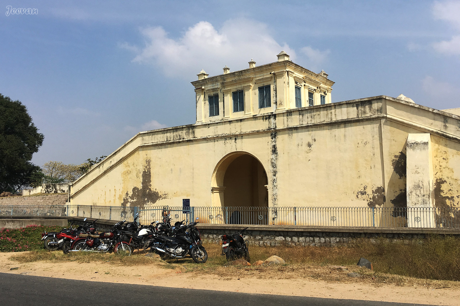
Kodiveri is about 16 km from Gobichettipalayam 
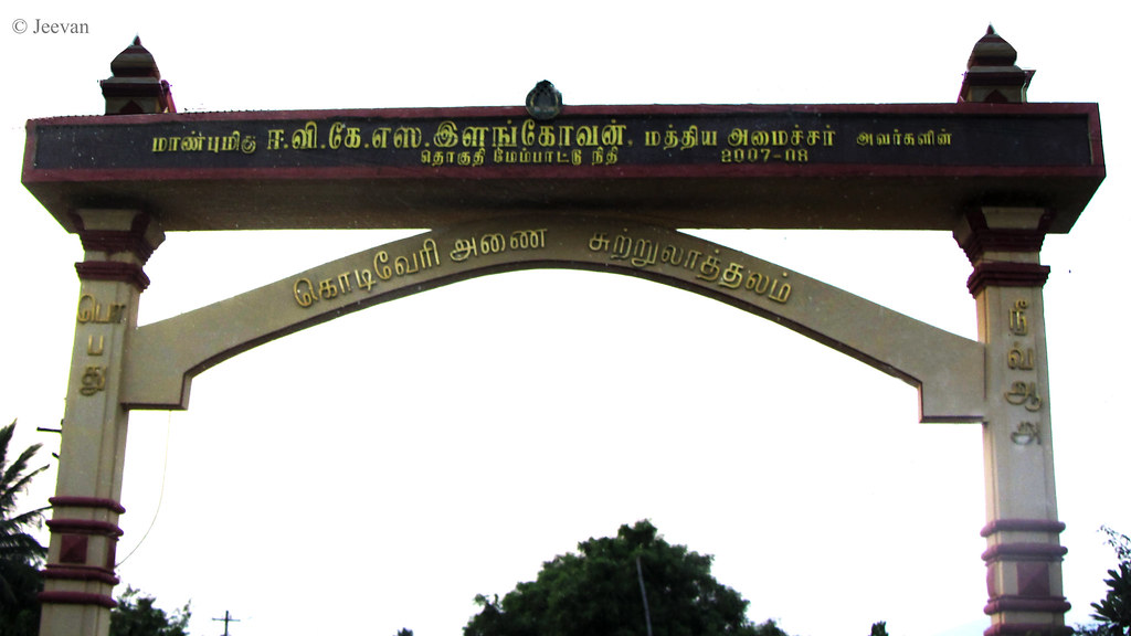
on the way to Sathyamangalam, which is about 14 km away from Kodiveri... a 
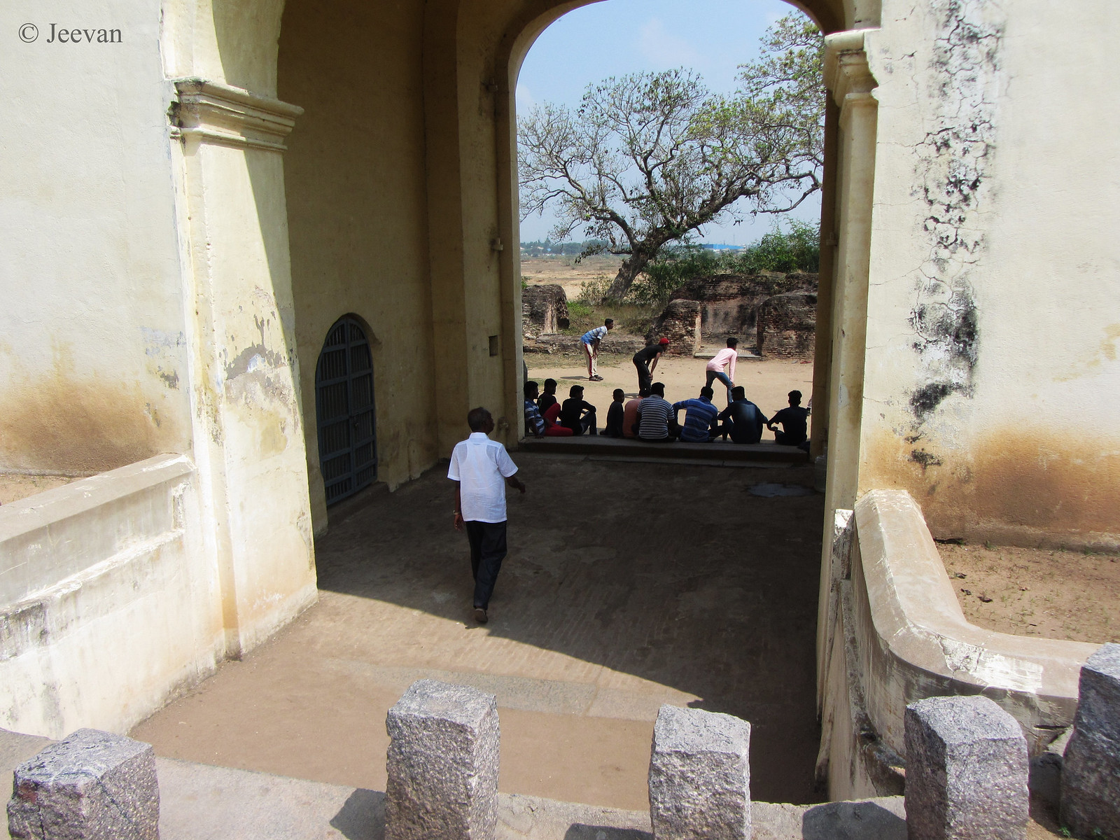
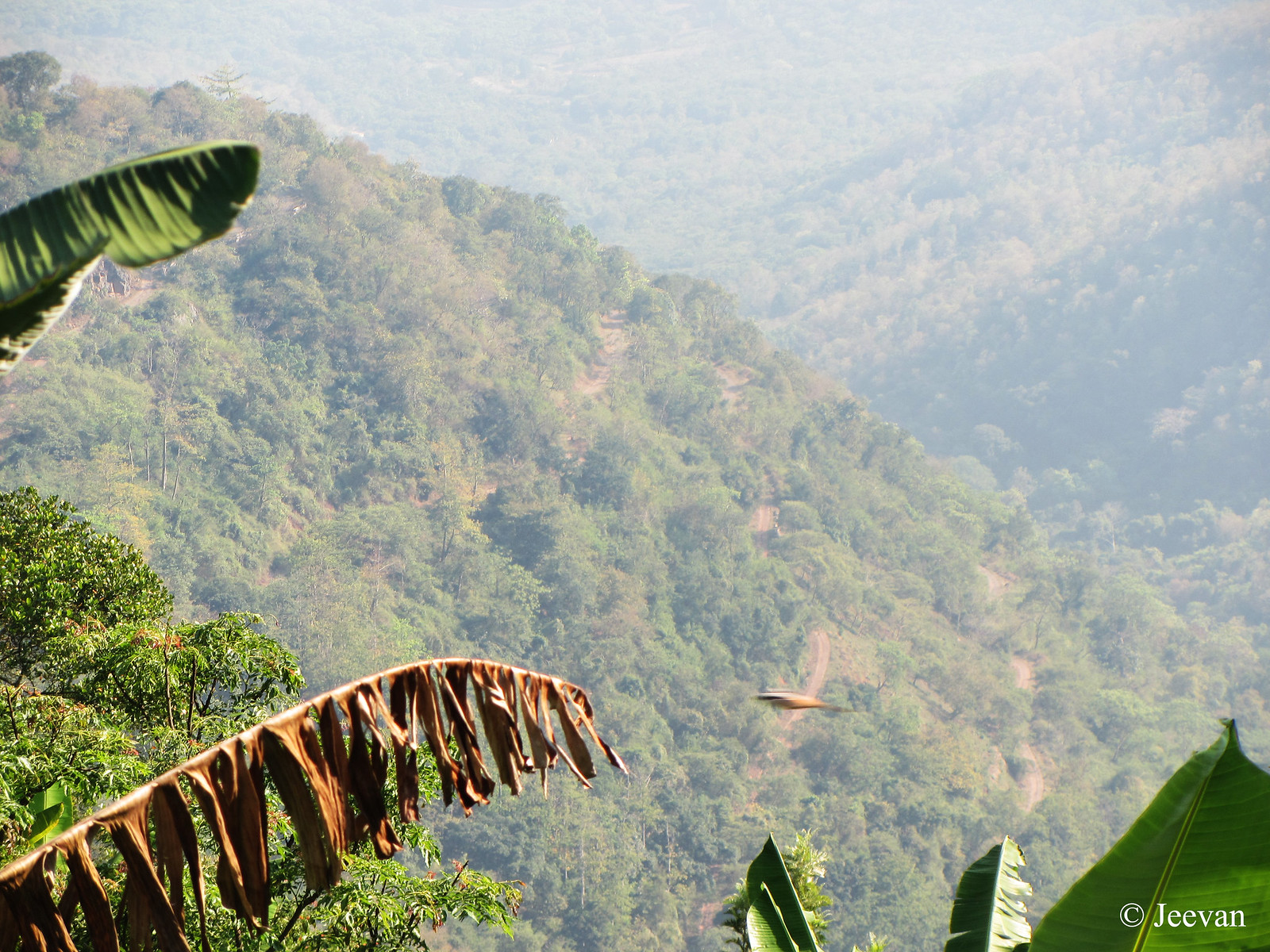
popular tourist part of this region, in Erode district. An arch on SH 15 (state highway) welcomes us to Kodiveri dam and in about 2km we reached the parking lot and the weather was continued to be hot. Though it was about 5.pm the sun doesn’t show 
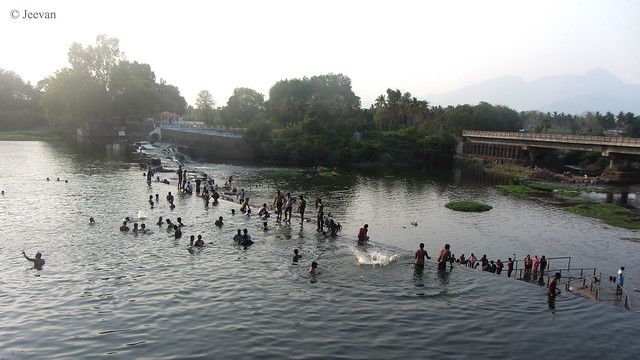
mercy but it wasn’t matter when got close to water…

IMG_5111

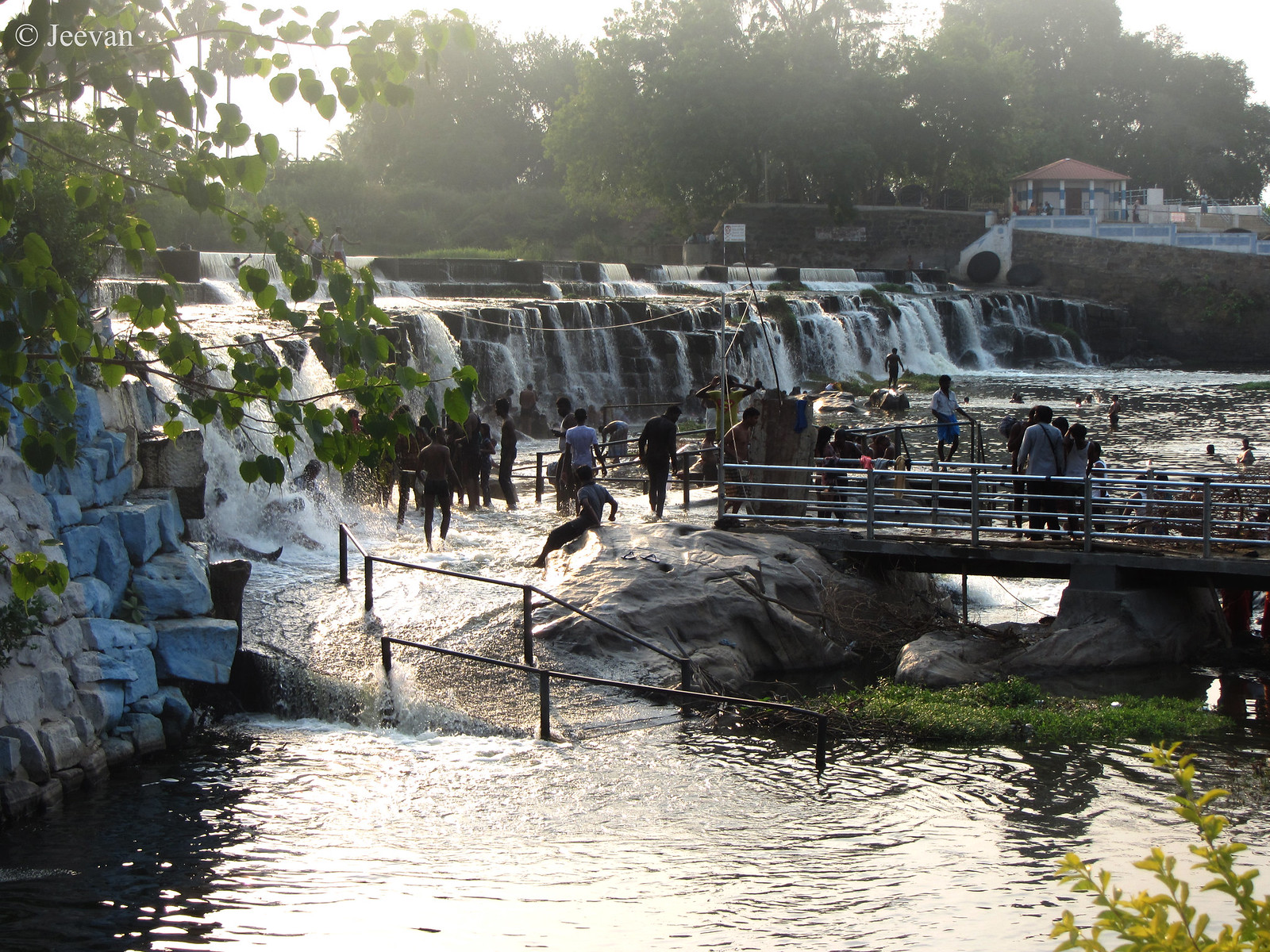
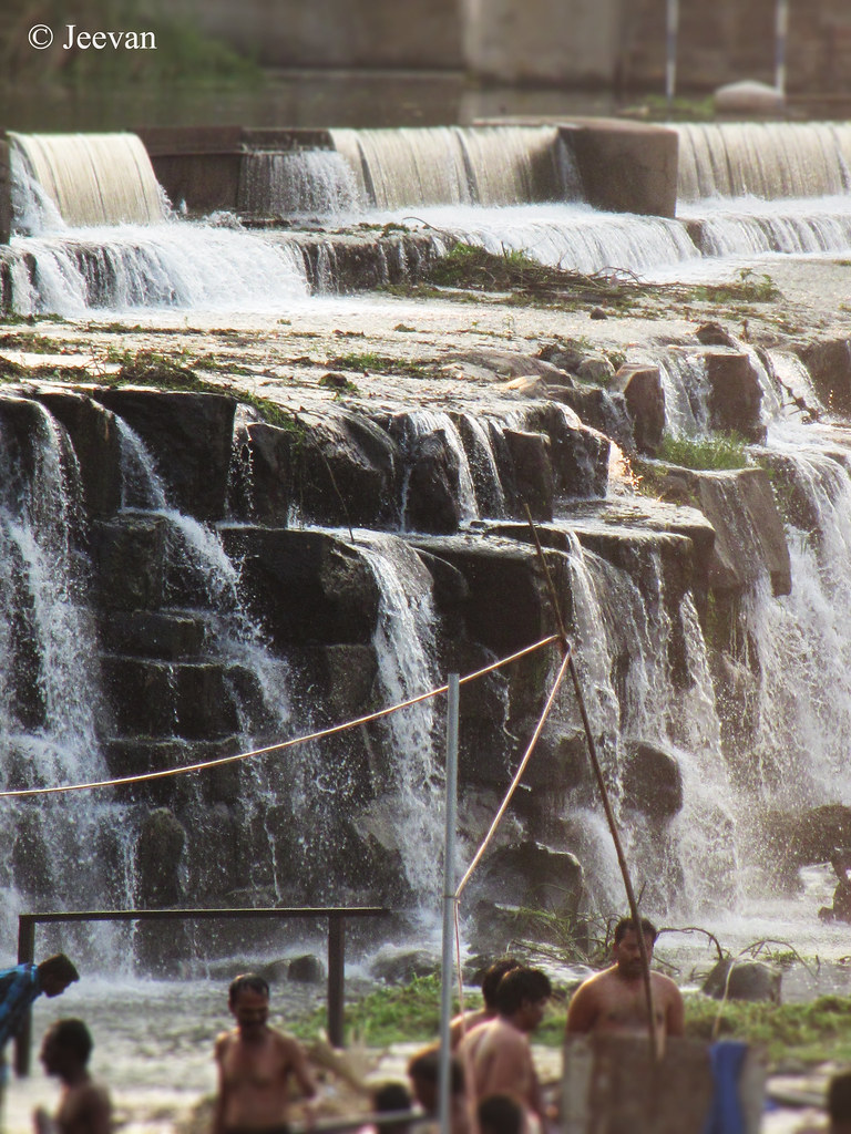
I was unsure about the water flow at the dam come falls, as our entire state is facing drought, I was so glad to see enough water at the dam leading great flow in the waterfalls. A minimum amount is collected as fee to enter the dam area but I couldn’t get really close to the water because of the unfinished pathway that make its way through small park area. I was content with the views on the waterfalls from either above or the pathway.

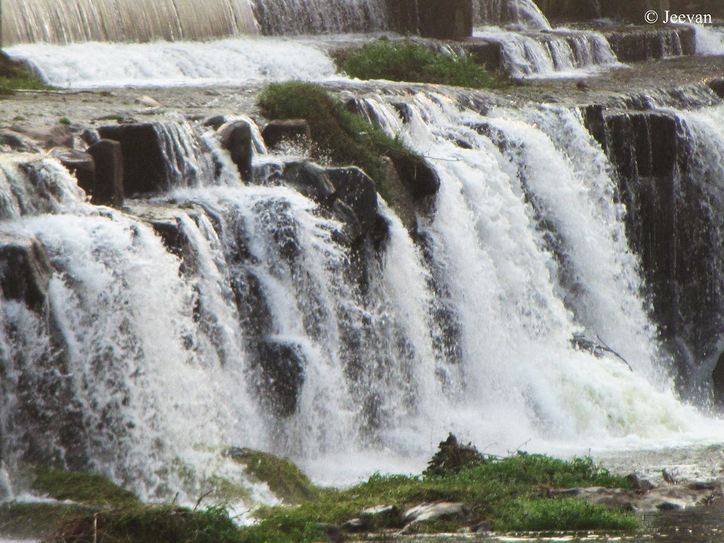
Kodiveri is a kind of check dam built across the Bhavani River and the downstream of the dam forms the waterfalls. The name “Kodiveri” is originated from the Tamil word meaning Tiger, which represents the large number of tigers lived in the forest area around the Dam. Not to forget the Sathyamangalam Tiger Reserve isn’t far away. The falls being not heavy, people are allowed to bath and swim in the pool of water as well as the falls, and reaching is also not difficult.


IMG_5114
Picture shot from few meters above the dam... and you could see the upcoming bridge to connect both banks of river
Entering of Kodiveri dam can be done from both sides of the Bhavani River, but the main entrance lies on the south through which we entered and to reach the other side there’s a separate route from Sathyamangalam. Right now an over bridge is under construction to connect the north and south side of the dam… but people also walk above the check dam on their own risk.  Similar to Hogenakkal, coracle ride is also available at the dam for fun and transport.

IMG_5151 IMG_5136

Coming to the important aspect of them dam was it was built 865 years ago! Constructed by the Kongalvan in the year 1125 AD, the dam was consisted of carving a 20-ft wall of rock. The stones were then interlocked with iron bars and lead in place of mortar.  There’s also two channels arise from the dam (Arakkan Kottai and Thadapalli channels) respectively, turning the land of Gobichettipalayam fertile due to the flow of channels.

IMG_5119
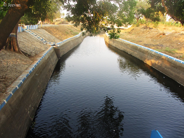
The southern  side Arakkan Kottai Channel
Bhavani River seems to have different ups and downs and to meet the need of the farmers surrounding and to manage the water crises the dam was decided to build. Since then, the irrigation level increased in the surrounding area and the dam provides water for over 25000 hectares of land.

IMG_5146

We spent about an hour at the dam site watching the waterfalls and the setting sun truly created an impact across the falls and I was delight to shoot utilizing the shimmering light effect. Glad they have laid some pathway at least to take photos from certain point of views… being Monday, the crowd was less at the dam site and mostly men were showing and swimming at falls and dam.

Kodivere is at a distance of 75-80km from Coimbatore and and it is well connected by road from any nearby towns and cities

Sunday, March 26, 2017

Exploring Kodai-Kumbakkarai Route, the very first road to Kodaikanal

IMG_9248
The Kodai-Kumbakkarai road was completely off at some places (click all photos for enlarge)
I love traveling and traveling on road-less travelled is my favourite. Wherever I go I look for places beyond the regular and I find it more exciting than what has been explored by many. Though many perhaps like taking such travels but don’t give much thought as it keeps them away from the comfort. But I am someone always like adventure and try to venture places that not many chose to travel or ready to lookout for. During my stay at Thandikudi, near Kodaikanal, I explored a route that was less travelled or abandoned since alternate and more comfort roads was developed. Though it was the first road to Kodaikanal many unknown about it.

IMG_9276
More than a century old road looks good  at few places toward Adukkam
The road that slides before Perumal Malai on the main road to the Kodaikanal, leads to the mango city Periyakulam via Adukkam village and Kumbakkarai waterfalls at the foothills. From the time I know about this road, a short route to Kodaikanal when going by Periyakulam or Theni, I want to explore it and travel as much possible.  I learned the road up to Adukkam village (half on the mountain) was travelable though the road wasn’t good and worst beyond that, we tied our best and it was possible only because of our Scorpio (SUV). For the most part of the road was unpaved or washed away as it wasn’t relayed after it was originally laid by the British. And the road is narrow which means facing a vehicle would make either take reverse or adjust space for the opposite to pass.

IMG_9307
The view of narrow winding road from the Adukkam village towards Kumbakkarai falls, which we didn't take.
The road wasn’t narrow but also potholed for large that any car would get bottom hurt unless it was an SUV or height ground clearance vehicle. The people from one of the vehicles (Hyundai Santro) that was coming up from Periyakulam warned us not to go further or beyond Adukkam as the road was in bad shape but still we managed up to Adukkam and turned back thinking it was our limit. Though few jeep drivers encouraged that we can go all the way to Kumbakkarai, as the villagers have cleared the road lately, we didn’t mind to go beyond and since it was late afternoon we don’t want to take risk and turned away with the view of winding lane down the hills.

IMG_9261
The pristine mountains and valleys... you could see a lone house (in white color) at a distance 
IMG_9274
Awesome view of mountains and  ridges across the valley
This road beholds views that are pristine and most part of the valley and mountains seem untouched by many. Being an initial and pretty old road to Kodaikanal, which seems to be laid in late 1800s or early 1900s, continue to hold the charm as most part of the route was undamaged by the tourism cottages or buildings. But I got to see few beautiful farm houses and bungalows and a stretch of coffee and orange plantations en route to the Adukkam, from there till the foothill is quite wild forest. Adukkam isn’t a big village and it comes to view few kms before on road resembling a small nest on the laps of mountains.

IMG_9281
Here's a view on the Adukkam village nestled in the valley and below is a close up on  the same
IMG_9282
The village is surrounded by hill banana plantation
I heard bullock carts were the first vehicles to take this road and we could see the roadside stone barriers and milestones still exists along with good patch of tar road at some places truly exhibits the quality of roads laid then. The day was sunny when we venture this route in early summer, though the weather doesn’t bother much as we continue to stay on mountains I couldn’t take more photos due to sun glares and reflection of windows many went dark images. Interestingly we met an old woman, when we stopped to take photos on the red coffee beans, scold us not to take photos on her coffee plants. She told her plants weren’t flourishing well already and you taking photos may get evil eye! lol 
IMG_9316
The red coffee beans, what the old woman said no to capture!